Chacchoben · The Pyramid Project
Explore the supplied pyramid model, identified by the project owner as Chacchoben, with site history and source comparisons.
Repaired presentation: local scan gaps filled, with synthetic stone finish and display support.
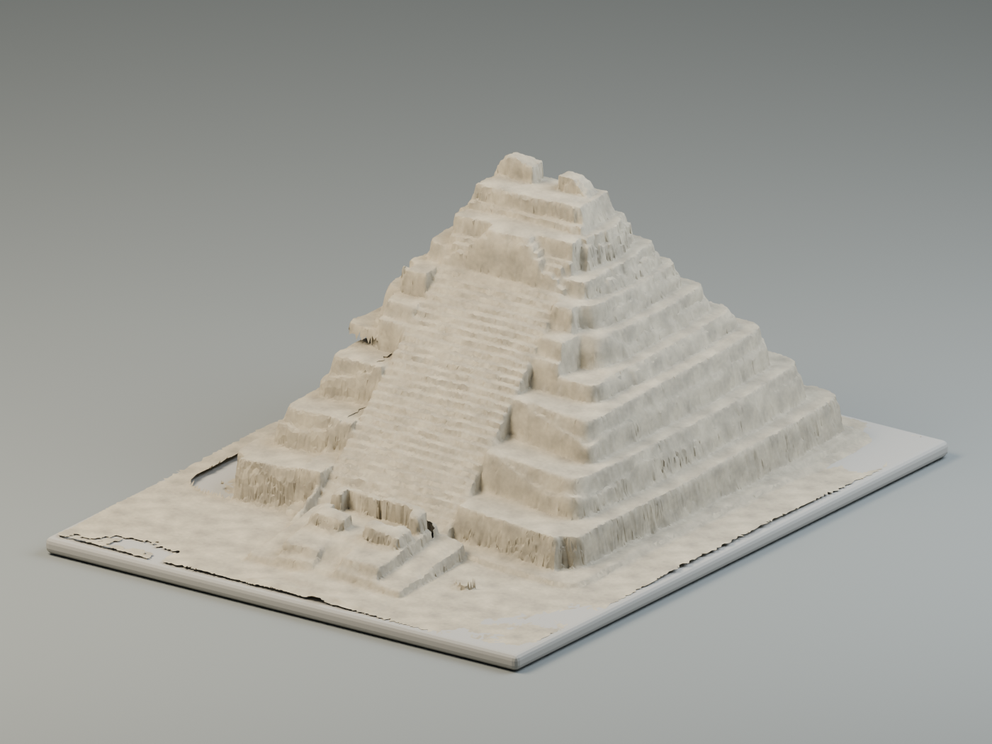
Photogrammetric version in progress. This is a preliminary presentation model.
Drag to rotate · Scroll or pinch to zoom. Web previews have reduced triangle counts; the supplied STL originals remain unchanged in the local build.
Presentation treatment: perimeter artifacts and small disconnected debris were removed from a copy. Stone colors, fine surface texture, lighting and the display support are synthetic. They do not represent recovered site photography. Local surface gaps have been filled for display; those patches are not archaeological evidence.
Surface gaps repaired for presentation
The default view closes local open boundaries in the captured surface. The damaged lower left flank includes inferred terrace surfaces adapted from the opposite side for presentation; these are not recovered masonry measurements. This improves continuity in the stones and forecourt without inventing architectural detail. Earlier unfilled geometry and all original-source previews remain available in the selector.
Cleaned for presentation
The cleaned version isolates the pyramid, stairs and small forecourt feature; removes the tall surrounding boundary artifacts; and lightly smooths scan noise. The display support is a separate modern object. Use the selector to compare against any supplied source variant.
What the files contain
Each supplied STL has 518,188 triangles. Coordinate comparisons show the same geometry in all three files: variant b is approximately 71.43% of the first file’s scale, with a vertical offset; variant c has a similar scale plus a slight rotation and offset. These are variants, not three separate structures.
Each original-source browser preview contains approximately 155,000 triangles; the cleaned preview contains fewer triangles after trimming. Simplification is for inspection and presentation; these previews are not substitutes for the originals in measurement or analysis.
About Chacchoben
Chacchoben is a Maya archaeological site in southern Quintana Roo’s lake region. Its ancient name is unknown; the modern name was adopted from the local ejido and is commonly translated as “place of red maize.” INAH places the beginnings of occupation in the Late Preclassic period, with major urban planning and public construction from the Early Classic, around 250 CE. Some civic and religious spaces were reused in the Late Postclassic, approximately 1200–1450 CE.
Its architecture initially followed Petén traditions and later incorporated features associated with Río Bec and Chenes. These are site-wide observations, not a precise date or architectural attribution for the scanned building. Source: INAH, Zona Arqueológica de Chacchoben.
Buildings and ceremonial life
The settlement’s core covers about 70 hectares. Official descriptions identify the Gran Basamento, Las Vías and Grupo II as major architectural groups. The Gran Basamento supported ceremonial buildings, and finds of late incense burners provide evidence of religious activity. INAH also describes the Templo Adosado, a later shrine built on the stairway of Templo 1. We have not yet confirmed whether this model corresponds to that named temple. Source: Secretaría de Cultura / INAH, Chacchoben site record.
How to read this digital model
The site identification comes from the project owner. The STL filenames alone do not establish the exact structure, capture date or physical scale. The model is a digital record of supplied geometry, not a reconstruction of how the temple looked in antiquity. New surface patches and synthetic stone materials belong to the presentation layer.
Historical sources reviewed October 31, 2026. For current visiting arrangements, consult INAH directly.
Research record
- Identifier
- DAA-0006
- Source files
- X_chacco.stl, X_chacco_b.stl, X_chacco_c.stl
- Geometry
- Stepped pyramid, staircase and surrounding captured surfaces
- Site identity
- Chacchoben, identified by the project owner; exact building designation not yet confirmed
- Chronology
- Building-specific date not supplied; the site chronology below is contextual
- Capture method
- Not established by STL geometry
- Units / scale
- Unspecified; no physical dimensions asserted
- Georeferencing
- No coordinate reference system supplied
- Textures / imagery
- No photographic textures or orthomosaic supplied
- Accuracy
- No control points or accuracy report supplied
- Rights
- Ownership reported by the project owner; third-party reuse licensing is not specified. NIRA access and deep linking are not used.
File names alone are not used to assign a location or archaeological attribution. More source documentation can be added without replacing this record.